Each year, the Atlantic hurricane season ushers in new challenges and a vigilant commitment to safety and preparedness.
In early 2024, meteorologists had anticipated an active hurricane season, with 24 named storms predicted, including 12 hurricanes, with 6 expected to escalate into major hurricanes (Category 3 or higher).
Names play a significant role in communicating the formation, progression, and potential impacts of these storms, aiding public awareness and helping authorities manage disaster response effectively.
Below we’ll explore the 2024 hurricane names, their importance, the actual storms associated with them, and provide a detailed look at each storm’s formation, category, impact, and the overarching lessons learned this season.
Understanding Hurricane Names and Their Significance
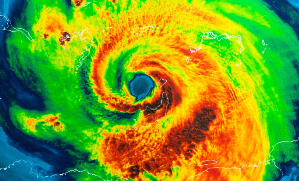
Hurricane names come from a rotating list maintained by the World Meteorological Organization (WMO).
These names alternate between male and female designations and are reused every six years unless a storm is so destructive that its name is retired.
Why Naming Matters
- Improved Communication: Quick and clear identification of individual storms.
- Public Awareness: Simplifies tracking and updates in media coverage.
- Emergency Coordination: Assists first responders in planning and executing disaster responses effectively.
The 2024 Atlantic hurricane season began with the name “Alberto” and ended with “William,” covering an alphabetically ordered list of 21 names.
Let’s take a closer look at the 2024 hurricane season and the storms that were named.
2024 Hurricane Names in Alphabetical Order
Here’s the full list of names assigned for this year’s storms. Italicized names indicate storms that were on the list but never used in 2024.
- Alberto
- Beryl
- Chris
- Debby
- Ernesto
- Francine
- Gordon
- Helene
- Isaac
- Joyce
- Kirk
- Leslie
- Milton
- Nadine
- Oscar
- Patty
- Rafael
- Sara
- Tony
- Valerie
- William
A Look Back at the 2024 Hurricane Season

The 2024 Atlantic hurricane season runs from June 1 through November 30, a period when the ocean’s warm temperatures are most conducive to storm development.
This year, environmental patterns like La Niña have influenced storm activity, intensifying the potential for hurricane formation by reducing wind shear over the Atlantic, a typical inhibitor of storm growth.
Key Predictions and Observations
- Season Forecast (by CAC):
- 24 named storms
- 12 hurricanes
- 6 major hurricanes
- Actual Storm Activity in 2024:
- 18 named storms formed
- 11 hurricanes
- 5 major hurricanes, including multiple Category 5 storms
Named Storms of 2024
Below is the list of named storms for the 2024 Atlantic Hurricane Season and key highlights on their impact, if any.
The dates of the storms include when their initial post tropical cyclone disturbance was recorded, to their final dissipation.
Alberto (June 17 to 20)
- Peak Strength: Tropical Storm
- Maximum Sustained Winds: 50 mph winds
- Path: Originated in the Gulf of Mexico and made landfall near Tampico, Mexico.
- Significant Impact: 20+ inches of rainfall in some areas, causing severe flooding, with estimated damage in the US at about $125 million.
Read more about Tropical Storm Alberto.
Beryl (June 28 to July 11)
- Peak Strength: Reached Category 5 hurricane status at its peak
- Maximum Sustained Winds: 160+ mph winds
- Path: Developed in the Atlantic’s Main Development Region, caused catastrophic damage in the Eastern Caribbean and then made final landfall near Matagorda, Texas, as a Category 2 storm.
- Significant Impact: Severe flooding and property losses across Southeast Texas, with one EF2 tornado recorded in Jasper, Texas, and estimated damages of $7.2 billion USD.
Read more about Hurricane Beryl.
Chris (June 30 to July 1)
- Peak Strength: Tropical Storm
- Maximum Sustained Winds: 40 mph winds
- Path: Formed in the Bay of Campeche and made landfall near Veracruz, Mexico.
- Significant Impact: 14+ inches of rainfall in Veracruz, leading to major flooding and mudslides.
Read more about Tropical Storm Chris.
Debby (August 2 to 10)
- Peak Strength: Category 1 hurricane
- Maximum Sustained Winds: 65 mph winds
- Path: Moved through the southeastern Gulf of Mexico and made landfall on Florida’s Gulf Coast near Tampa Bay.
- Significant Impact: Flash flooding due to up to 19 inches of rainfall in coastal Florida, along with three weak tornadoes in North Carolina.
Read more about Hurricane Debby.
Ernesto (August 11 to 20)
- Peak Strength: Category 2 hurricane
- Maximum Sustained Winds: 100 mph
- Path: Formed as a tropical storm east of Lesser Antilles and made landfall in Bermuda as a Category 1 hurricane.
- Significant Impact: Structural damage and power outages to the Caribbean, specifically Puerto Rico.
Read more about Hurricane Ernesto.
Francine (September 8 to 14)
- Peak Strength: Category 2 hurricane
- Maximum Sustained Winds: 100 mph
- Path: Formed as a tropical storm in the southern Gulf of Mexico and made landfall in south Louisiana as a Category 2 hurricane.
- Significant Impact: Brought up to 8 inches of rainfall in affected areas, resulting in substantial flash flooding.
Read more about Hurricane Francine.
Gordon (September 11 to 17)
- Peak Strength: Tropical Storm
- Maximum Sustained Winds: 45 mph winds
- Path: Formed in the Atlantic and remained distant without landfall.
- Significant Impact: No significant impacts.
Read more about Tropical Storm Gordon.
Helene (September 23 to 28)
- Peak Strength: Category 4 hurricane
- Maximum Sustained Winds: 140 mph winds
- Path: Started as Potential Tropical Cyclone Nine disturbance in the Caribbean Sea and then strengthened, eventually moving throughout the southeast US, including most of Florida, Georgia and South Carolina.
- Significant Impact: Caused up to 15 to 20 feet of storm surge along the Florida Panhandle and catastrophic flooding across the other states in its path.
Read more about Hurricane Helene.
Isaac (September 25 to 30)
- Peak Strength: Category 2 hurricane
- Maximum Sustained Winds: 100 mph winds
- Path: Stayed in the Atlantic without making landfall.
- Significant Impact: No significant impacts.
Read more about Hurricane Isaac.
Joyce (September 27 to 30)
- Peak Strength: Tropical Storm
- Maximum Sustained Winds: 50 mph winds
- Path: Formed from a tropical wave which came from the west coast of Africa, but remained in the Atlantic Ocean throughout its cycle.
- Significant Impact: None notable; served as an opportunity to emphasize the importance of preparedness.
Read more about Tropical Storm Joyce.
Kirk (September 29 to October 7)
- Peak Strength: Category 4 hurricane
- Maximum Sustained Winds: 145 mph winds
- Path: Traveled across the Atlantic without striking significant landmasses, however curved towards parts of northwestern Europe in its last days as it weakened.
- Significant Impact: Brought heavy rainfall and winds to parts of Western Europe.
Read more about Hurricane Kirk.
Leslie (October 2 to 12)
- Peak Strength: Category 2 hurricane
- Maximum Sustained Winds: 105 mph winds
- Path: Moved within the Atlantic and avoided populated areas.
- Significant Impact: None directly in 2024.
Read more about Hurricane Leslie.
Milton (October 5 to 10)
- Peak Strength: Category 5 hurricane
- Maximum Sustained Winds: 180 mph winds
- Path: Slammed into the west coast of Florida as a Category 3 hurricane, with sustained winds of 120 mph, and later downgraded to a Category 1 hurricane as it moved inland.
- Significant Impact: Resulted in over 18 inches of rainfall, 10 feet of storm surge and over 40 tornadoes, including at least 3 EF3 tornadoes.
Read more about Hurricane Milton.
Nadine (October 18 to 20)
- Peak Strength: Tropical Storm
- Maximum Sustained Winds: 60 mph winds
- Path: Formed in the western Caribbean and strengthened into a tropical storm before making landfall near Belize City, then proceeding to weaken into a tropical depression.
- Significant Impact: Heavy rainfall ranging from 4 to 12 inches as well as gusty winds, leading to downed trees and power outages.
Read more about Tropical Storm Nadine.
Oscar (October 19 to 22)
- Peak Strength: Category 1 hurricane
- Maximum Sustained Winds: 80 mph winds
- Path: Developed just east of the Turks & Caicos Islands and then made landfall in the Bahamas and then the province of Guantanamo.
- Significant Impact: Brought heavy rainfall, strong winds, flash floods and storm surges before moving into the Atlantic Ocean.
Read more about Hurricane Oscar.
Patty (November 2 to 4)
- Peak Strength: Tropical Storm
- Maximum Sustained Winds: 65 mph winds
- Path: Formed in the Atlantic Ocean, traveled east towards Ponta Delgada and then dissipated.
- Significant Impact: No significant impacts.
Read more about Tropical Storm Patty.
Rafael (November 13 to 10)
- Peak Strength: Category 2 hurricane
- Maximum Sustained Winds: 120 mph winds
- Path: Initially formed in the central Caribbean Sea just south of Jamaica, then moved northwest toward the Gulf of Mexico, making landfall in western Cuba.
- Significant Impact: Caused severe damage to housing, infrastructure, and agriculture due to its heavy rain, strong winds and widespread flooding.
Read more about Hurricane Rafael.
Sara (November 13 to 18)
- Peak Strength: Tropical Storm
- Maximum Sustained Winds: 50 mph winds
- Path: Developed in the western Caribbean Sea before making landfall in the northern coast of Honduras and then moved north over Belize before dissipating.
- Significant Impact: Widespread devastation across Central America, including flooding, landslides and river overflows.
Read more about Tropical Storm Sara.
Unused 2024 Storm Names
The following names were not used during the 2024 Atlantic hurricane season:
Impacts of the 2024 Atlantic Hurricane Season
The 2024 Atlantic hurricane season will be remembered as one of the most catastrophic and costly in history, with AccuWeather experts estimating damages and economic losses estimated at an unprecedented $500 billion.
Throughout the season, five hurricanes, along with an unnamed subtropical storm, contributed to widespread devastation across the United States.
Tornado outbreaks caused further destruction, such as with Hurricane Beryl, which generated tornadoes that damaged homes and businesses over 1,000 miles from its landfall.
The 2024 hurricane season was exceptionally cost. Let’s look at the key figures:
- Hurricane Helene is estimated to have caused over $225 billion in damages, breaking storm surge records and leading to flooding disasters in the Carolinas and throughout the southeast.
- Hurricane Milton inflicted $160 to $180 billion in damage and brought a series of intense tornado outbreaks across Florida.
- Additional storms, such as Debby, Francine, and an unnamed subtropical storm, caused billions in losses and severe flooding.
Experts warn of the hidden toll hurricanes take on individuals and families, such as lost possessions, increased financial strain, and lasting mental health challenges.
This season’s record-breaking destruction underscores the urgent need for comprehensive disaster preparedness and proactive support for impacted communities.
Despite these challenges, local governments and aid organizations have worked tirelessly to mitigate risks and deliver aid.
Readiness and Preparedness Lessons from the 2024 Hurricane Season

Over the decades, certain storm names have become infamous due to their destruction and impact.
These storms are remembered for their physical effects and their influence on disaster response, policy changes, and public awareness.
Government and Private Sector Collaboration
- Extending partnerships with organizations and leveraging technology to enhance early warning systems and evacuation readiness.
- Collaboration with companies like Tidal Basin has shown success in scaling resources and augmenting emergency management capabilities.
Localized Emergency Plans
- Encouraging municipalities to develop localized action plans that reflect specific risks tied to geography, infrastructure, and demographics.
- Focus on creating flexible, scalable strategies to adjust to the severity of storms and ensure efficiency at all stages of the response.
Investing in Resilient Infrastructure
- Implementing pre-disaster mitigation strategies, such as strengthening flood defense systems, updating drainage infrastructure, and reinforcing critical facilities like hospitals and communication hubs to withstand severe weather.
- Continued funding through grants and partnerships ensures long-term resilience planning across all sectors.
These are just a few examples of strategies that communities can implement to help be ready for the next hurricane season.
Wrapping Up the 2024 Hurricane Season and Looking Ahead
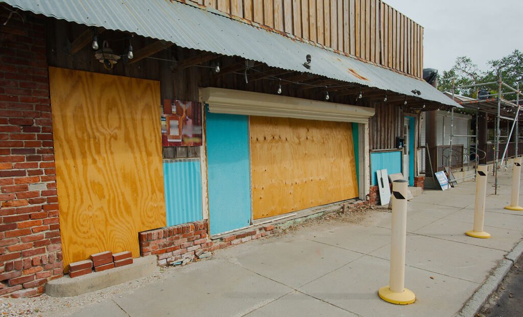
The 2024 hurricane season has been a stark reminder of the power of nature and the importance of preparedness. From record-breaking storms like Beryl, Helene and Milton, to the widespread flooding left by Alberto, this year has tested the resilience of communities across the United States and Caribbean.
As we brace for the 2025 hurricane season, early preparedness and proactive action remain critical. Staying informed, reinforcing infrastructure, and fostering a culture of readiness will ensure our ability to adapt and respond to the evolving challenges posed by hurricanes and severe storms.
Want to explore how your community or organization can better prepare for hurricanes? Contact Tidal Basin for expert advice and tailored disaster preparedness solutions.
