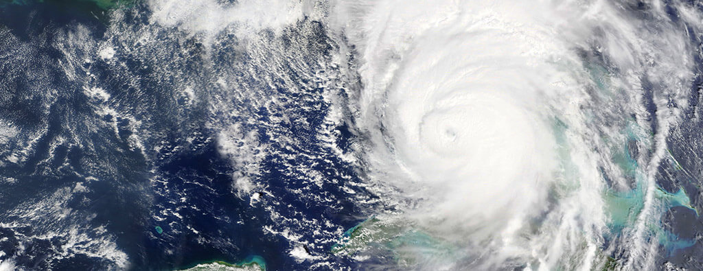
Tropical Storm Chris became the third named storm of the 2024 Atlantic hurricane season, following closely on the heels of Tropical Storm Alberto and Hurricane Beryl.
Tropical Storm Chris in 2024 emerged from a tropical wave that departed the west coast of Africa on June 20.
Moving rapidly across the Atlantic, its development was initially hindered by strong westerly wind shear and fast forward motion. By June 28, the system slowed and entered the Bay of Campeche, where warm waters and reduced wind shear fostered its formation.
On June 30, Chris officially reached tropical storm status, with sustained winds of 40 mph. Landfall occurred shortly after, near Alto Lucero, Veracruz, Mexico, during the early hours of July 1.
Despite its short lifespan, Chris brought significant rainfall to eastern and southeastern Mexico, with over 14 inches recorded in Veracruz, leading to flooding and mudslides. The storm weakened rapidly upon moving inland, dissipating completely on July 1 due to interaction with Mexico’s mountainous terrain.
Key Observations:
- Winds and Pressure: Peak winds were recorded at 40 mph with a minimum pressure of 1005 mb at landfall.
- Rainfall Impact: Up to 14.21 inches of rain caused serious flooding in regions such as Veracruz and San Luis Potosí, resulting in blocked roads and minor damages.
- Forecast Challenges: While the potential for development was noted early, meteorologists had low confidence that it would form, due to initial unfavorable conditions.
The Legacy of Tropical Storm and Hurricane Chris
«Chris» is a recurring name in the Atlantic hurricane naming list that’s rotated every six years.
Here’s a historical overview of notable storms that have had the name Chris:
Tropical Storm Chris in 1982
Formed in the Gulf of Mexico on September 9, 1982, Chris reached peak winds of 65 mph before making landfall near the Texas-Louisiana border. It left behind almost 7 feet of storm surge and widespread rainfall of up to 10 inches in Louisiana, causing minimal damage.
Tropical Storm Chris in 1988
This fast-moving storm formed between Africa and the Caribbean on September 10, 1988, brought nearly 4 inches in heavy rain in Puerto Rico and caused three fatalities. It weakened after landfall in South Carolina but brought tornado outbreaks and flooding across the eastern US.
Hurricane Chris in 1994
A brief hurricane lasting just two days, Chris, which formed on August 16, 1994, peaked at 80 mph while passing 75 miles east of Bermuda. Although it avoided direct landfall, its wind field showcased the potential damage of strong vertical wind shear.
Tropical Storm Chris in 2000
Tropical Storm Chris formed from a tropical wave off Africa on August 12, 2000. It became a tropical depression on August 17, 2000, and a tropical storm the next day.
However, strong wind shear quickly disrupted the system, and it dissipated within 24 hours. Chris was one of only two tropical storms since 1997 to be weakened into dissipation by shear in the deep tropics.
Tropical Storm Chris in 2006
Chris originated from a tropical wave that moved off Africa on July 26, 2006, maintaining convection as it traveled westward. It became a tropical depression on August 1, 2006 near Barbuda and strengthened into a tropical storm shortly after, reaching peak intensity near Anguilla.
Increasing wind shear and dry air caused Chris to weaken as it passed north of Puerto Rico and Hispaniola, eventually dissipating over the Bahamas on August 4, 2006.
Tropical Storm Chris in 2012
This early-season storm transitioned into a hurricane on June 21, 2012, at an unusually high latitude, making it the farthest-north hurricane to develop during the month of June. The only other hurricanes to form north of 35°N so early in the season were unnamed hurricanes in June 1959 and June 1893.
Although it avoided significant land impact, Chris demonstrated how hurricanes could form under unique atmospheric conditions.
Tropical Storm Chris in 2018
Chris of 2018 was initially hindered by dry air before it strengthened into a tropical storm on July 7, 2018, and became Hurricane Chris on July 10, 2018. The hurricane reached peak winds of 105 mph, thanks to warm waters and low wind shear.
Chris weakened over cooler waters and became an extratropical cyclone near Newfoundland on July 12, 2018. It moved northeast and dissipated into a trough southeast of Iceland by July 17, 2018. Despite its brief lifespan, Hurricane Chris in 2018, like its 2012 counterpart, highlighted the different ways storms can evolve and transition.
Why Tropical Storms Get Named
Storm naming began to clarify communication in weather forecasts and warnings. Human names are assigned in alphabetical order to Atlantic storms exceeding tropical storm strength, or about 39 mph.
The World Meteorological Organization (WMO) manages the naming of tropical cyclones, using a rotating list every six years. Names are retired if they become associated with significant destruction or loss of life, promoting clarity in communication among meteorologists, the media, and the public.
The Importance of Storm Names
Improved Communication
Assigning names to storms simplifies public messaging, especially during busy seasons with multiple storms forming simultaneously.
- Names are easier to remember than technical codes or numbers.
- Clear naming ensures the public can follow warnings and updates without confusion.
- It aids emergency response coordination and helps life-saving information reach a broad audience more effectively.
Cultural Legacy
Storm names often carry historical significance and leave a lasting impact.
- Names like «Katrina» or «Sandy» have become synonymous with the devastating hurricanes they represent.
- By naming these storms, they help communities remember past disasters and spark discussions about preparedness and climate change.
Easy Identification
Storm names streamline tracking and communication for all stakeholders.
- Named storms are easier to reference in conversations, maps, and reports.
- They prevent confusion when multiple storms develop simultaneously.
- This clarity enhances coordination across agencies and communities, saving time and potentially lives.
Safety and Resilience Tips for Local Governments
When tropical systems like Chris approach, staying prepared makes all the difference.
Taking the right steps helps protect both communities and critical infrastructure. Here are some essential safety tips to keep in mind:
Strategic Evacuation
- Map out evacuation routes well in advance to avoid last-minute confusion.
- Establish shelters and accommodations for vulnerable populations, including the elderly, disabled, and those without transportation.
- Conduct regular evacuation drills to ensure readiness.
Proactive Communication
- Utilize social media, text alerts, and local news to provide real-time updates on storm paths and safety measures.
- Create multilingual communication channels to reach diverse communities.
- Set up a hotline for emergency assistance and information.
Flood Defense
- Clear storm drains, gutters, and ditches to prevent blockages and flooding.
- Reinforce levees, dams, and flood barriers in high-risk areas.
- Implement natural flood defenses like planting vegetation, such as mangroves along riverbanks and shorelines.
Stockpile Essentials
- Make sure sandbags, fuel, and emergency kits are readily available in disaster-prone regions.
- Distribute survival kits with flashlights, batteries, non-perishable food, and first aid supplies to communities in advance.
- Establish centralized storage for rapid deployment of resources.
Emergency Power
- Install backup power grids in essential facilities like hospitals, water treatment plants, and communication hubs.
- Encourage businesses and households to invest in portable generators.
- Inspect and maintain power infrastructure to reduce outages during storms.
Education Programs
- Launch awareness campaigns about tropical storm risks, including storm surges, heavy rainfall, and strong winds.
- Educate residents on how to create emergency plans and kits for their households.
- Collaborate with schools to teach children about disaster preparedness.
Frequently Asked Questions About 2024 Tropical Storm Chris
What defines a tropical storm?
A tropical storm is a weather system with organized convection and sustained winds between 39 to 73 mph.
What happened to Tropical Storm Chris in 2024?
The beginning elements of eventual 2024 Chris were first seen on June 20, 2024. Initially, the storm system struggled to develop due to strong winds and fast movement. By June 30, 2024, it became a tropical depression in the Bay of Campeche and later strengthened into a tropical storm with around 40 mph winds.
Tropical Storm Chris hit Veracruz, Mexico, on July 1, 2024, causing heavy rain up to 14.21 inches, leading to flooding and mudslides. It quickly weakened over the mountains and faded the same day.
How does 2024 Chris compare to other storms named Chris?
The 2024 version of Tropical Storm Chris was relatively weak but caused significant rainfall and flooding in Mexico, unlike its hurricane counterparts, like Chris in 2018, which reached Category 1 intensity.
Why do hurricanes weaken after landfall?
Hurricanes lose strength after landfall because they interact with terrain, like mountains, which disrupt their circulation, and they are cut off from the warm ocean waters that fuel them.
What preparations should governments take for storms like Chris?
Efforts include stockpiling supplies, issuing clear evacuation routes, and pre-deploying emergency response teams to high-risk areas.
The Importance of Tropical Storm Chris and Its Previous Storms
Tropical Storm Chris in 2024 reminds us that even weaker storms can have substantial effects, leading to flooding, disrupted transportation, and property risks.
Whether monitoring storms for their historical legacy or preparing for potential impacts, Chris illustrates the importance of vigilance, science, and community resilience in facing the uncertainties of nature.
For more information and tools to stay prepared, visit our Hurricane Resource Center.


