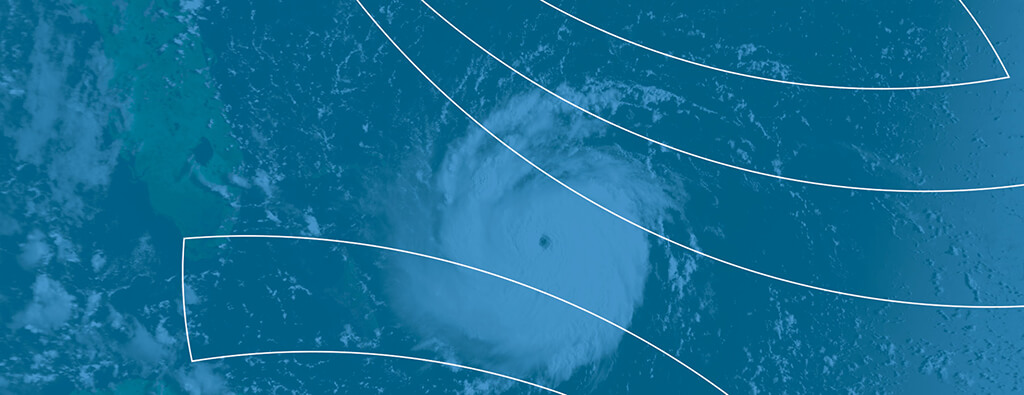
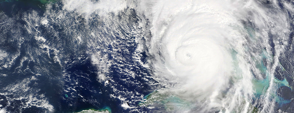
Hurricane Andrew remains one of the most infamous tropical cyclones to have struck the United States.
Over 30 years after it made landfall, this Category 5 hurricane serves as a reminder of the power and devastation that nature can unleash, as well as the importance of preparation.
Hurricane Andrew’s Development
Hurricane Andrew began as a tropical wave off the west coast of Africa on August 14, 1992.
Here’s a step-by-step look at its evolution:
- Formation: By August 16, the wave grew into a tropical depression and was upgraded to Tropical Storm Andrew a day later. Though its development initially stagnated, conditions for its strengthening improved as it traveled westward.
- Rapid Intensification: On August 22, Andrew reached hurricane status 650 miles southeast of Nassau, Bahamas. Within the next 24 hours, it swiftly intensified, becoming a Category 5 hurricane with sustained winds of 175 mph and a central pressure of 922 mb.
- Bahamas Landfall: Andrew first struck Eleuthera Island in the Bahamas as a Category 5 storm on August 23, briefly weakening to a Category 4 hurricane before moving toward Florida.
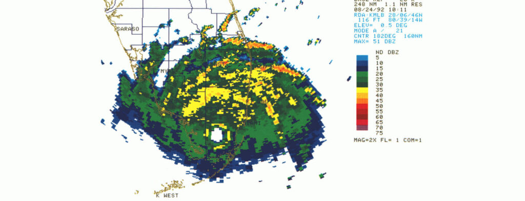
- Florida Impact: Andrew regained Category 5 strength and made landfall in South Florida on August 24, devastating Dade County, Florida and nearby areas with winds of 165 mph.
- Second Landfall in Gulf of Mexico: After crossing Florida, it entered the Gulf of Mexico, landing in South Louisiana as a Category 3 hurricane with winds of 115 mph on August 26.
- Andrew Weakens: By midnight on August 27, Andrew had weakened to a tropical depression and then further dissipated.
Key Stats About Hurricane Andrew
Understanding Andrew’s sheer strength and impact involves examining its meteorological statistics and aftermath:
- Hurricane Strength: Hurricane Andrew was a Category 5 hurricane during landfall in Florida, until it downgraded to a Category 3 hurricane in Louisiana.
- Winds: Andrew’s winds reached 175 mph at its peak.
- Lowest Pressure: 922 millibars, making it the third most intense hurricane to hit the U.S. mainland at the time.
- Cost of Damage: $26 billion, making it the most expensive hurricane disaster in U.S. history until surpassed by later storms.
- Storm Surge: Heights of 5 to 8 feet measured mainly near Cypremort Point, LA and others across areas of landfall.
- Rainfall: South Central Louisiana received up to 11.92 inches, the highest total for the storm. Other regions received 5 to 9 inches of rainfall.
- Tornadoes: There were various tornadoes that formed because of Hurricane Andrew. The strongest tornado formed in LaPlace, Louisiana, rating as an F3 and causing $25 million in damage.
These figures highlight the immense power Andrew brought to every region it affected.
When Did Hurricane Andrew Form?
Andrew originated as a tropical wave off the west coast of Africa on August 14, 1992. The system gradually gained momentum as it traveled across the Atlantic, becoming a tropical depression on August 16 and then Tropical Storm Andrew by August 17.
Initially, unfavorable atmospheric conditions slowed its development, and the system almost dissipated by August 20.
However, as conditions improved, it rapidly strengthened and was classified as a hurricane on August 22 while southeast of Nassau, Bahamas.
The storm underwent an explosive intensification, reaching Category 5 on August 23 with wind speeds of 175 mph. By the time it struck Florida, Andrew had secured its place in history as one of the most powerful hurricanes on record.
Timeline and Path of Hurricane Andrew
Andrew’s path demonstrated the complexity and unpredictability of tropical systems.
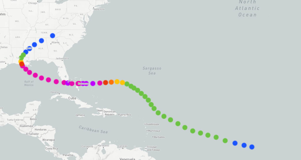
Here’s a look at its timeline and trajectory:
- August 14 to 16: Andrew forms as a tropical wave off Africa, then becomes a tropical depression.
- August 17: Upgrades to Tropical Storm Andrew as it crosses the Atlantic.
- August 20: Weakens briefly but shifts west and encounters favorable conditions.
- August 22 to 23: Rapidly intensifies to Category 5, hitting Eleuthera Island in the Bahamas.
- August 24: Makes landfall in south Florida as a Category 5 with sustained winds of 165 mph.
- August 25: Crosses the Gulf of Mexico, regains strength, and heads toward Louisiana.
- August 26: Makes a second U.S. landfall near Point Chevreuil, Louisiana, as a Category 3 storm.
- August 27 to 28: Weakens into a tropical depression and merges with a frontal system over the mid-Atlantic states.
How Big Was Hurricane Andrew?
Although Andrew was relatively small in size compared to other hurricanes, the compactness of its eyewall resulted in tremendously destructive winds within a concentrated area.
Compared with broader hurricanes like Katrina, Andrew’s winds were more intense over the areas directly impacted, contributing to catastrophic structural damage, particularly in southern Florida.
Learning from Hurricane Andrew for Future Preparedness
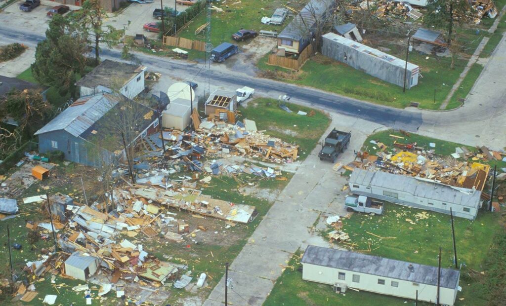
Since Hurricane Andrew’s landfall, there are several lessons we’ve learned that continue to inform hurricane planning and resilience strategies:
- Stronger Building Codes: Andrew’s destruction in South Florida led to the enforcement of stricter building codes, particularly for roofing materials and wind-resistant construction.
- Evacuation Planning: Andrew highlighted the need for efficient evacuation plans, especially for highly populated regions.
- Improved Forecasting: Technological advancements have vastly improved hurricane tracking and intensity predictions, giving communities more time to prepare.
- Public Awareness Campaigns: Educating the public about hurricane preparedness and resilience remains a critical component of mitigating potential damage.
Building Better Resilience
Hurricane Andrew forever changed construction codes and disaster preparedness policies in Florida. Homes built after 1992 were designed to withstand stronger hurricanes, especially in highly vulnerable coastal regions.
The storm also prompted the relocation of NOAA’s headquarters to a more hurricane-resilient building.
Advancements in Hurricane Forecasting
Hurricane Andrew revealed critical weaknesses in forecasting technology and response systems, a reality that fueled significant advancements in hurricane prediction and preparedness:
- Enhanced Models: Improved computer models, such as spaghetti models, provide more accurate forecasts, giving communities additional time to evacuate and prepare.
- Dropwindsonde Technology: Aircraft investigations now deploy advanced instruments like GPS dropwindsondes for better wind speed measurements.
- Public Awareness Campaigns: The aftermath of Andrew showed the importance of educating residents about the dangers of storm surges, wind damage, and flooding.
Preparedness Strategies
Preparedness involves hardening infrastructure, strengthening community emergency plans, and ensuring individuals understand how to safeguard themselves and their properties.
Max Mayfield, former direction of the National Hurricane Center, said, “The battle against hurricanes is won during the off-season.”
Frequently Asked Questions About Hurricane Andrew
When was Hurricane Andrew?
Andrew formed on August 16, 1992, and dissipated by August 28, 1992.
What category was Hurricane Andrew?
At its peak, Hurricane Andrew was a Category 5 hurricane, with sustained winds of 175 mph.
When did Hurricane Andrew hit Florida?
Hurricane Andrew struck South Florida on August 24, 1992, with landfall near Homestead, Florida.
What was the path of Hurricane Andrew?
Andrew traveled westward from the Atlantic Ocean into the Bahamas, made landfall in South Florida, crossed into the Gulf of Mexico, and hit Louisiana before dissipating over the Eastern U.S.
How big was Hurricane Andrew?
Although relatively compact in size, Andrew’s eyewall produced some of the most intense winds of any U.S. hurricane, concentrated within a small radius.
Where did Hurricane Andrew hit?
Andrew devastated towns in South Miami-Dade County, Florida, and later struck South Louisiana, causing widespread destruction.
The Legacy of Hurricane Andrew
Hurricane Andrew remains a powerful reminder of the immense destruction hurricanes can cause and the critical importance of preparedness.
Three decades later, it stands as a cautionary tale of nature’s force and a call to action for strengthening resilience in the face of increasing storm threats.
Andrew forever changed the lives of those it impacted and spurred significant improvements in disaster response, community infrastructure, and early warning systems across the U.S.
The lessons learned from Andrew provide a vital roadmap for navigating the challenges of tomorrow’s hurricanes.
